The ideal all-in-one solution for applying the benefits of an aerial drone to your project.
With the video footage, photos and digital data obtained from the flight mission, we can create high-detail GIS imagery and elevation data (see below), as well as an animated video, an interactive 3D/AR model for your website and presentations or even a real-world scale virtual reality experience.
Rugged terrain, technical infrastructure, or active mine-site? We’re experts in terrain-aware flight and autonomous flight and can fly safely within any project layout.
G.I.S. Imagery
High-resolution georeferenced 2D imagery, primed for map-making.
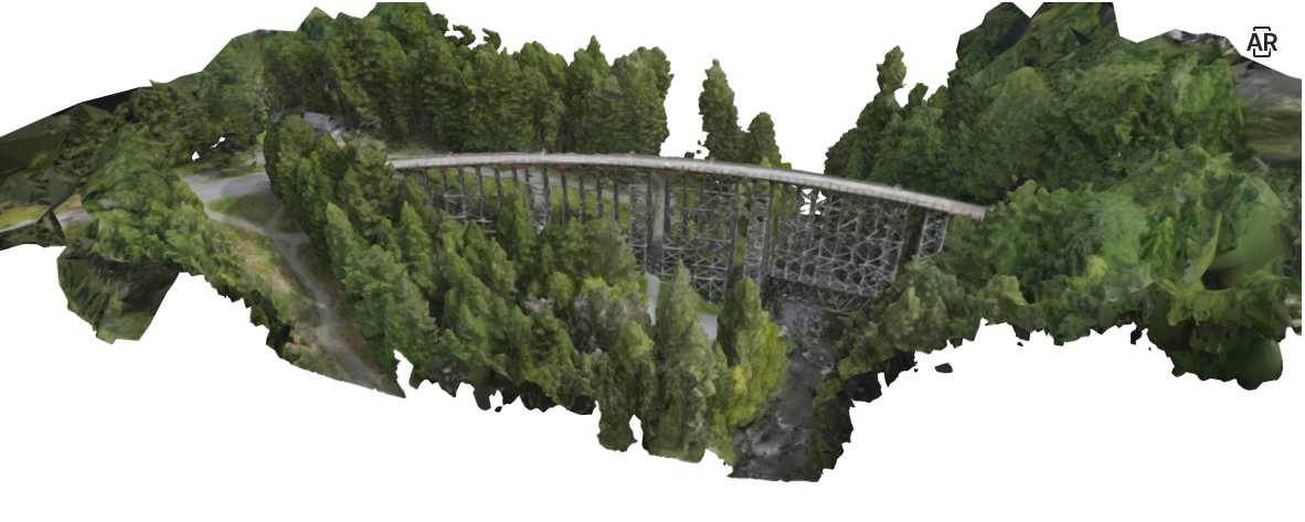
3D Meshes
Photo-realistic digital 3D models of landscapes and infrastructure.
Elevation Data
Digital Elevation Models covering your area of interest plus RTK precision data.
Video, Photos & 360s
Aerial and ground-level footage of your project area and highlights.
G.I.S. Imagery
Georeferenced, orthorectified aerial imagery that drops directly into all of your G.I.S. and mapping software.
Our drone-acquired 2D map imagery provides a level of detail (1 to 2 cm) that’s far beyond the resolution and quality of traditional airborne and satellite imagery.
Digital Elevation Data
As well as capturing map imagery, our drones also create high-resolution elevation models (and contour lines) of your main project area.
We produce the two main types of digital elevation models (DEM), namely Digital Surface Models (DSM) which includes tree heights and buildings/infrastructure, as well as ‘bare earth’ Digital Terrain Models (DTM).
We also provide RTK (Real time kinematic) survey-quality data for projects requiring ultra high precision.
3D Textured Meshes
Photo-textured 3D meshes are superior to 2.5D G.I.S. data in that vertical and near-vertical surfaces such as pit walls and buildings are covered with photography, and objects with under-hangs, such as bridges or trees, are accurately depicted. We integrate these 3D ‘drone scans’ into our presentation products for the highest realism.
Video, Photos & 360s
4K HDR aerial video, slow motion, time lapses, 48MP stills, high-detail panoramas and rotatable 360s. We’ll edit the raw video footage and produce a selection of final clips that we can include in a full corporate video or advertisement.
Lessons, Training & Consultation
Paraminerals offers on-site drone flight lessons and mission training for your field and IR teams – no experience required. We’ll set you up with one of our micro (<250g) trainer drones or you can use your own machine. We will teach you the fundamentals of safe flying and can also assist and advise you with any of your first-time drone tasks and projects, either remotely or on-site.
Our Drones
DJI Mini 3 Pro
Small and powerful 4K microdrone
DJI Air 2S
All-purpose quadcopter
DJI Phantom 4 Pro
Industry-standard 3D mapping
DJI Mavic 3 Enterprise RTK
High-accuracy flights and data
Let's Connect
Ready to transform your vision into reality? Reach out to Paraminerals today. We’re here to discuss your project needs and provide personalized solutions.